Drawing Ride 1
Bicycling from Seattle, Washington, to the Northern Idaho/Montana border, along a nearly continuous route made up of 12 rail-trails converted from abandoned railroad corridors; a distance of approximately 450 miles.
Ride 1 map made in collaboration with cartographer Molly Roy using GPS coordinates recorded on ride.

On a grey, drizzly early-summer morning in June of 2014, we set out from the westerly point of Golden Gardens Park on Puget Sound, in Seattle, Washington, riding the Burke-Gilman Trail (originally the Seattle, Lake Shore & Eastern Railway) inland along Salmon Bay, Lake Union, and Lake Washington, drawing an undular line through the city. Looping south to Lake Sammamish, we picked up the Sammamish River Trail (a levee trail) to East Lake Sammamish Trail (former section of the Burlington Northern Santa Fe (BNSF) railroad), to the Issaquah-Preston and the Preston-Snoqualmie Trail (both part of the former Seattle, Lake Shore & Eastern Railway).
We camped that evening near Snoqualmie Falls, near the western flank of the Cascade Range; in the morning we biked the southern portion of the Snoqualmie Valley Trail (an extension of the Chicago, Milwaukee, St. Paul & Pacific Railroad, also known as the Milwaukee Road) to Rattlesnake Lake.
From here we picked up the Palouse to Cascades State Park Trail (formerly the western section of the Old Milwaukee Railroad), climbing 3,015 feet into the Cascades to Snoqualmie Pass, through the 2-mile Snoqualmie Tunnel -- the longest tunnel in the United States which has been converted into a trail -- and down the other side, into the long shadows of evening falling across Keechelus Lake.
-
Inside the Snoqualmie Pass Tunnel
GoPro video footage of Snoqualmie Pass Tunnel, a 2.25 mile-long, unlit tunnel that bores through the Cascade Mountain Range in Washington. Built by the Chicago, Milwaukee, St. Paul and Pacific Railroad as part of its western expansion to Seattle, it was completed in 1914, and was the longest tunnel along the entire Milwaukee route. It’s now part of the Palouse to Cascades State Park Trail.
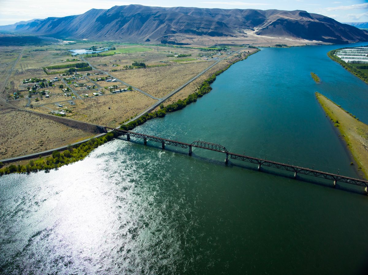
We rode for the next couple of days along the Palouse to Cascades State Park Trail, out of the Cascades and into the Columbia River Basin. The trestle across the immense Columbia River still exists but at the time of our ride it was in derelict, uncrossable form. Ferried over the river via I-90, we reconnected to the trail in Beverly, Washington. We cycled the rugged and rocky unimproved portions of the trail across Central and Eastern Washington and crossed the border into Idaho.
In Northern Idaho we rode the 72-mile paved Trail of the Coeur d'Alenes (former Northern Pacific Railroad), developed as one form of recompense to the Coeur d'Alene tribe and the State of Washington for the extensive damage to the area caused by lead and silver mining in the area. The Northern Pacific Multi-Use Trail (former Northern Pacific Railroad) and a section of the Route of the Olympian (Milwaukee Railroad) connected us to the magnificent and improbable Milwaukee Railroad’s passage through the Bitterroot Mountains, now known as the Route of the Hiawatha (and its complicated allusions), after the passenger trains that traveled the route in the early to mid-part of the 20th century.
-
Just west of Keechelus Lake
-
Along the Yakima River, west of Ellensburg, WA
-
Near Ellensburg, WA
-
Columbia River trestle, 2014