Drawing Ride 2
Bicycling from the Northern Idaho/Montana border, across Montana, eastern Idaho and Wyoming along rail-trails converted from abandoned railroads; a distance of approximately 450 miles.
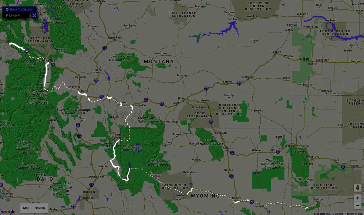
We began Drawing Ride 2 in June of 2017, where we left off on Drawing Ride 1, at the Northern Idaho/Montana border, and rode trails built, for the most part, from sections of the Pacific extension of the Chicago, Milwaukee, St. Paul and Pacific Railroad (also known as the Milwaukee Road), the Northern Pacific, and the Oregon Pacific Rail lines.
The Milwaukee Railroad originally ran along the western flank of Lake Michigan, where it served Chicago, Milwaukee, and St. Paul; from the Lake it traveled across the Midwest and later was extended to the West Coast, terminating in Seattle, Washington. The Northern Pacific railroad was the first transcontinental railroad, completed in May, 1869.
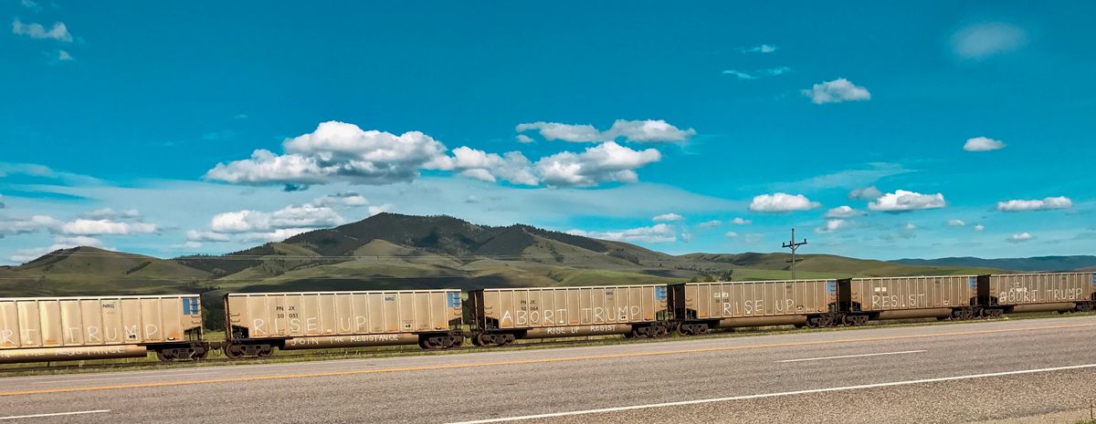
This section of the route is composed of shorter trails, with many gaps between them, this part of the country having converted fewer abandoned railroads. Ride 2 took place at an unusual moment in recent history; our citizenry and politics greatly divided, our perceptions of what our country is and who ought to make it up at odds. We communicate at lightning speed but along narrow roads, with a perversely increased ability to isolate ourselves. Perhaps it is not different than in the past but there is a steady agitation in the air, and what is common feels elusive.
I was nervous in anticipation of our trip, uncertain how or if the recent election (of 2016) would impact the reception we received. But our encounters were all individual, highly local, and people were curious if not delighted. How critical it is not to let floating fears and political stereotypes stop one from being out in the world, in fact, how essential to go outside the familiar!
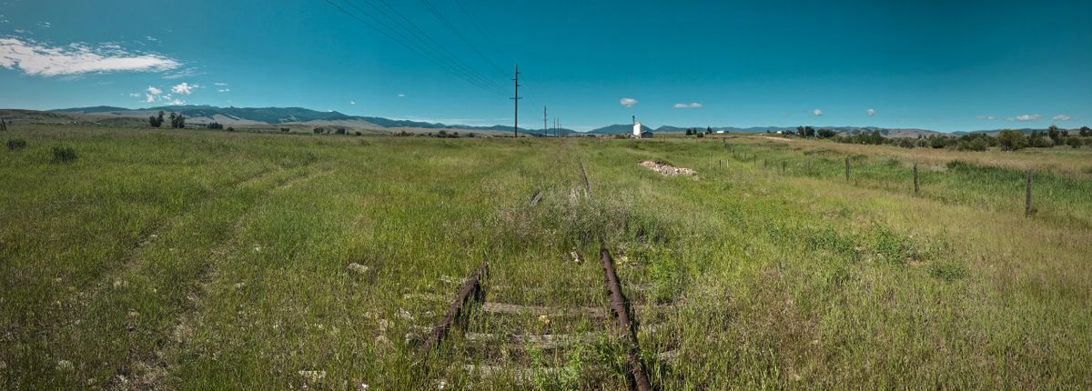
An area covering parts of Wyoming, Montana and Idaho, which had been inhabited by Native Americans for 11,000 years, came to be referred to as Yellowstone by early colonists. In the 1880’s, it was designated the first national park in the United States. To encourage tourism to this newly designated romantic-sublime landscape, the Park and members of some of the large railroad companies met to plot ways to connect visitors via rail. The Northern Pacific railroad built a spur from Livingston, Montana, to the northern entrance of the park. Except for a small fragment out of Livingston, the 50-mile spur has not (yet) been converted to a trail; we explored it in hopes of riding a significant portion of it: what we found were grassy vestiges of the railroad bed, much of it behind barbed wire. Until we met up with a river-running photographer beside the Yellowstone River, as we were scouting for an access point along a gravel road, who told us of a ridable 13-mile stretch a little ways south of us. We bicycled along the gravel road until we'd passed the last country house; I thought I saw a faint outline of a rail bed close to the river, across a field studded with thistles, so we walked our bikes gingerly across it, and yes! it was the old rail bed. We rode it to the northern entrance gate of Yellowstone National Park.
After a respite in Yellowstone Park, we spent four days riding the former Oregon Pacific Rail line through the Caribou-Targhee National Forest in Idaho, a rail corridor that also offered early access (but from the west) to Yellowstone National Park 一 and verges on the Grand Tetons. Within Grand Teton National Park, two greenways (paths designated for non-motorized transport: cyclists, walkers, cross-country skiers…) made up the next section of our route. East of the Grand Tetons and Yellowstone, through the rest of Wyoming, only a handful of short rail-trails exists. We traveled through the Wind River Reservation, riding the Wyoming Heritage Trail and exploring the Chicago NorthWestern railway corridor and the towns along its route 一 Riverton, Shoshoni, and Casper, where our adventure ended.